Places to avoid this Bank Holiday weekend!
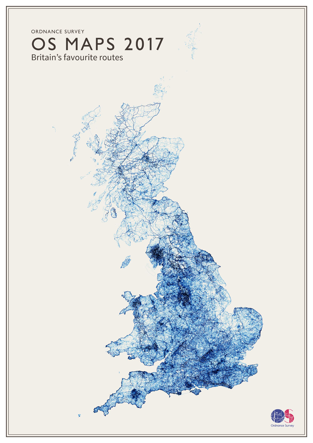
Ordnance Survey have released heatmaps of where people have been plotting walking and cycling routes for the past twelve months.
>>> Check out all our best mountain bike routes
The maps are bit like the ones you can find on Strava but it’s interesting to see the OS’s versions. OS release these maps and charts every year and for 2017 there have been some spots changing in popularity.
OS divides the country down into square kilometres and counts the number of routes passing through each square. A league table is the result.
The data is derived from users of Ordnance Survey’s route-plotting phone app so there is arguably a degree of skewed results at work; there won’t be very many older folk using route-plotting maps, nor will there be very many casual daytrippers using it. But still, this is all fascinating stuff for map geeks.
Top 20 locations 2017
- SH6054 Snowdon (Summit)
- SK1285 Edale
- NY2107 Scafell Pike (Summit)
- SK0786 Edale Cross
- SK0886 Edale (Jacob’s Ladder)
- NY3704 Ambleside
- SH6154 Snowdon (Pyg Track)
- SK1283 Edale (Mam Tor)
- SK1384 Edale (Hollins Cross)
- SK1185 Edale
- SO0121 Pen y Fan
- SH6455 Pen-y-pass
- NY2806 Langdale Fell (Cumbria Way)
- NY2208 Great End (Scafell Pike)
- NY3307 Grasmere (Centre)
- SK1085 Edale (Upper Booth)
- SK1284 Edale (Cold Side)
- NY2308 Allen Crags (Scafell Pike)
- NY3415 Helvellyn (Summit)
- NY2623 Keswick
They’ve analysed nearly half a million routes that have been drawn up by the public who have used Ordnance Survey’s their “digital outdoor products” in the past year (phone apps mainly).
Snowdon is by far the most popular specific place to plot a route but the prime honeypots are, rather surprisingly, no longer in the Lake District. The main two hotspots are Snowdonia and the Peak District area surrounding Edale. With Edale taking up six of the top ten spots, the Peak District has overtaken the Lake District in OS’ busiest places chart.
Nick Giles, Managing Director of Ordnance Survey Leisure, says: “With its easy access from Manchester and Sheffield, and it being either the start or end of the Pennine Way, depending on which way you’re walking it, it’s easy to see why it features so heavily in our league table with almost 21,000 routes.”
>>> Five routes to only do when it’s quiet
OS revealed 2016’s top walking destinations
Back in December 2016, Ordnance Survey, revealed the UK’s most popular outdoors destinations for that year.
Ordance Survey: “With the year coming to an end we’ve taken a look back at the most popular destinations searched by walkers on our popular OS Maps online service.
“An amazing 1.4 million destination searches were carried out via our online version of OS Maps in 2016. So, where were people hoping to explore?
“National Parks in England and Wales are well represented, and are stunning parts of the country to visit. Sadly, no Scottish destinations quite made the top 10, with Aviemore (1551) and Glencoe (1473) just missing out.”
- Snowdon 4388 searches
- Keswick, Cumbria 3374
- Edale, Derbyshire 2750
- London 2185
- Ambleside, Cumbria 2165
- Brecon 1892
- Castleton, Derbyshire 1892
- Coniston, Cumbria 1814
- Malham, N Yorkshire 1726
- Patterdale, Cumbria 1590