The highest detail maps still cost money but the fundamental features of the app are free
GPS computers or GPS apps on your smartphone are all well and good when it comes to plotting and following road routes but for exploring off-road there’s nothing better than having an Ordnance Survey map.
Ordnance Survey have been producing maps for centuries and they’ve been producing mapping apps for a good number of years now too, with mixed success.
>>> Garmin launches the first GPS bike computer with Strava live segments
Improved functionality and design
The mapping that Ordnance Survey make is excellent. They also don’t give it away from free. Previous apps from Ordnance Survey have lacked in functionality and user-interface which often lead to frustration and annoyance from the paying customer.
The new free-to-download app from the Ordnance Survey finally offers a good level of functionality and control – for free. The very finest detailed maps are still behind a subscription-based paywall but the majority of the route plotting and other features are free of charge.
>>> Danny MacAskill helps launch the new Lezyne GPS (VIDEO)
A month-by-month subscription costs £3.99 with yearly subscriptions starting from £19.99. So they’re perhaps still on the pricey side for riders who don’t venture away from their local loops or trail centres but for riders who enjoy experiencing new areas the pricing seems much more reasonable.
What are the features?
Draw a crude straight line from point to point and the mapping app will ‘snap’ it to lay-over the nearest public right of way.
You can choose to set the app up for walking, running or cycling modes.
There’s a built in weather forecast screen.
You can decide how hilly or flat you want a route to take.
You can find pubs and cafes on the route. Or even plot a route based on them.
Uses GPS for a lot of the fundamental functions so not 100% reliant on mobile signal.
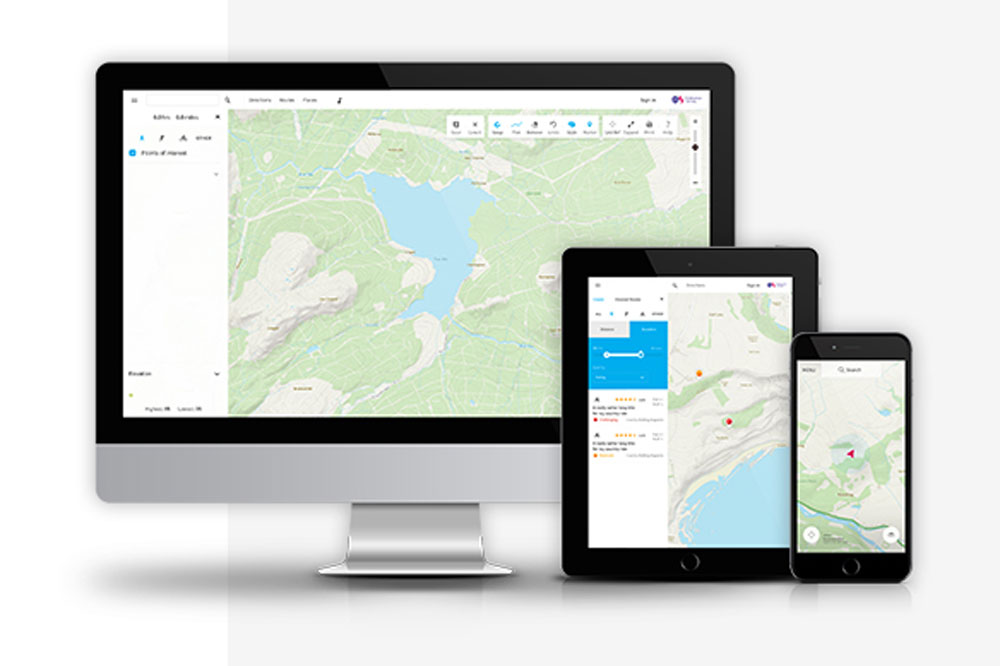
Use OS Maps across all your devices. View, create and sync your activities between desktop and mobile.
National Park trail finding function. Just two taps will automatically give you the most enjoyable, accessible and safe route between two points in a National Park.
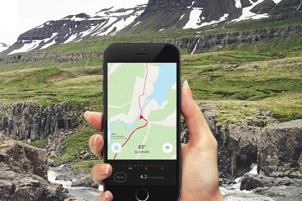
Record and follow routes.
Plot a route to follow or share – or record your route while you’re out and about.
>>> mbr’s free GPS route files available to download from across the UK
What costs money?
The highest detailed maps, basically. There are a few other things that are restricted in the free version. Have a look at the table below.
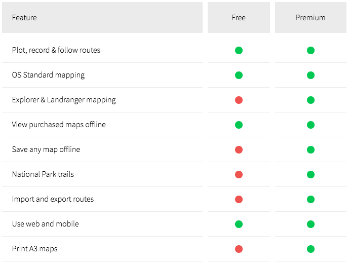
The maps are not free but you do get access to all of Ordnance Survey’s maps for the whole of the UK once you subscribe. This is equivalent to 607 paper maps.
Offline mapping is available – this means you can download maps to your device and use them later even without having a phone signal.