Trail-checking in the comfort of your own home.
In Ordnance Survey’s Aerial 3D feature you can view plotted routes from any angle you wish and from a multitude of distances and heights.
>>> Check out all our best mountain bike routes
Ordnance Survey have unveiled their new Aerial 3D trail viewing tool. It’s part of their OS Maps Premium package. Existing subscribers can start playing with Aerial 3D right now. For non-subscribers there’s a seven day trial being offered to coincide with this product launch.
The service also incorporates 750,000(!) routes that have been uploaded from walking, cycling and mountaineeering publications as well as plenty from keen members of the public.
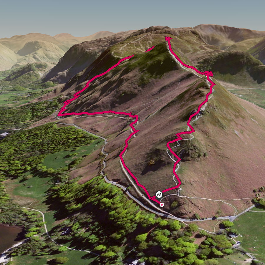
With Aerial 3D you can view trails and mountains in impressively rendered 3D, check a planned route or even search for the best viewpoints for your Instagrams – all without leaving your computer.
“The most extraordinary digital rendering of a mountain landscape we’ve seen… never before has it been possible to view the character of a mountain, a ridge or a route so dramatically and convincingly before leaving home. With this new tool in OS Maps route planning – and the associated excitement levels – have just taken a huge leap forwards!” – Simon Ingram, outdoors journalist.
“Ordnance Survey Leisure MD Nick Giles said: “The introduction of the Aerial 3D viewing tool is another major step in making the outside enjoyable, accessible and safe for all. The new feature is perfect for anyone thinking of hiking, biking or climbing in Britain. It helps them to plan in accordance with their skills and experience. And importantly, being able to see routes clearly in this way should help people get inspired to do more in the great outdoors and at the same time keep safe.”