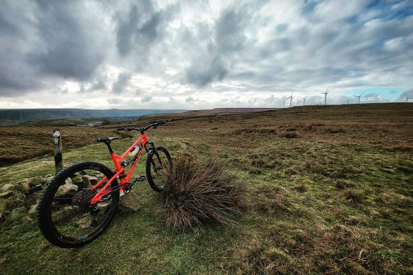
Those of us who are permanently on the lookout for somewhere new to ride - chasing the dirty dragon with ever diminishing returns like it's mountain biking morphine - we are always flicking through bike magazines and browsing websites looking for new routes
There are certain things that we all look for when we’re weighing up whether to do a certain route. There are things that we like to see on a route map. Trees, close contour lines, trails alongside ravines and streams are usually cool. There are things that we don’t like to see on a route map. Things that cause us instantly to dismiss a route out of hand. Lots of road, not much gradient, no sign of any woodland bits, Byways and ‘white roads’.
I’m as guilty as anyone for being an armchair route assessor. I shouldn’t be. If I think about it, some of my favourite rides involve loads of road – often as much as 75% in fact. I know that there’s amazing riding to be had in the tree-starved Yorkshire Dales, for example. I also know that’s there’s not many contour lines in Thetford Forest yet the riding there contains some awesome fast and furious singletrack attack.
You can’t judge how good a route is going to be by looking at a map of it. We all should stop second guessing the route designers (who have actually ridden the route and spent time and effort to share it with the group remember) and be a bit more trusting and open minded.
Last week’s Trailfinder General: There’s more to mountain biking than singletrack
There will still remain the Unwritten Law. We mountain bikers like loops. We only like loops. There is something deeply ingrained in our route desires that dictates that a route must navigate around an area – ideally not taking in the same spot twice – until we arrive back at where we started. What’s all that about?
The only exception for this must-be-a-loop dictat is when it involves a summit point significantly above 2000ft. You know, yer Snowdons and yer Skiddaws and such. In such rare topography then the Unwritten Law bears a footnote that states: a mountain biker is allowed to do a straight up and straight back down the same way route so long as it’s up a big feck off mountain.
Well, I’m opening my prejudiced mind as wide as possible this year. Well, whenever Covid permits anyway. I’m going to head down (and up and along) lots of dead-ends. I’m going to ride trails twice in one ride; once one way and then I’m going to turn around and ride it back the other way.
Whilst poring over some Ordnance Survey maps of the Lake District the other night (we don’t get much of a Freeview signal where I live so we make our own entertainment) I began to notice some bridleways that I’ve never ridden. This took me a bit by surprise as I thought I’d pretty much ridden everything you can do on a bike in the Lakes. Closer inspection of said bridleways revealed that they were dead ends. They either stopped altogether or they suddenly switched to being a footpath (we’ve all come across these infuriating switch-trails before). This usually seemed to occur at the point where the bridleway met a parish boundary. I guess parish path officer’s of yore were often a bit jobsworth.
Anyway this decision of mine has instantly opened up a few more corners of countryside for me to point my pedals at. It’s exciting to be looking at maps as seeing such dead-end as opportunities rather than restrictions. I don’t expect to have a particularly high success rate. I’m expecting the majority of the tracks to be in poor shape and heavy going. Such is the nature of an ‘abandoned’ trail. But if one in ten dead-ends turns out to be a cool trail then I’ll be happy. Any hit of morphine is worth it.